
Ladawan:1875 Dumont's geological map of Europe.jpg
Orihinal na file (4,277 × 3,674 na pixel, pakadakula: 2.66 MB, tipo nin MIME: image/jpeg)
Sumaryo
| Pagladawan |
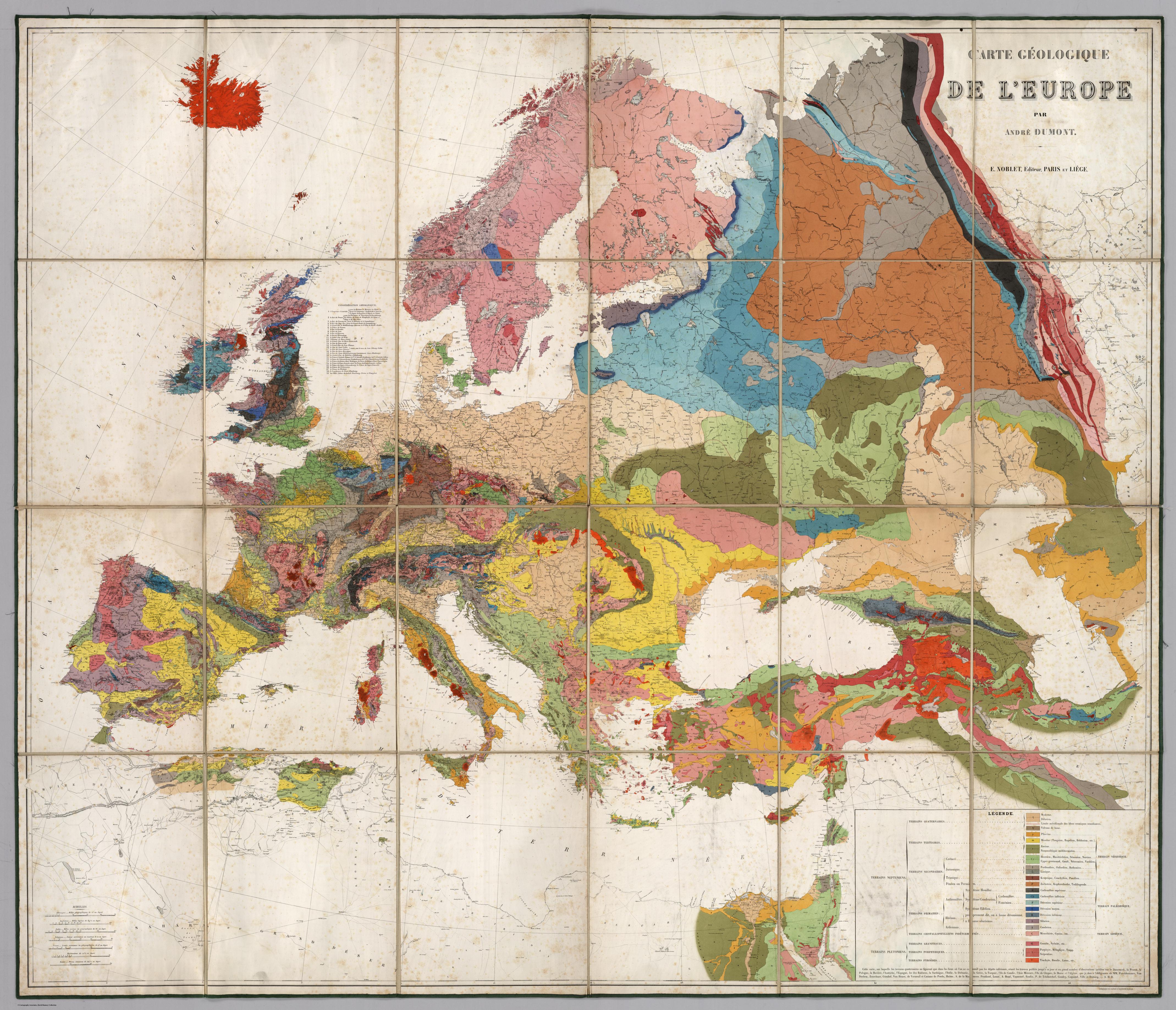
English: Geological map of Europe - Carte Geologique De L'Europe.
author: Dumont, Andre, published in 1875. Publisher : E. Noblet Publisher Location : Paris Type : Case Map Size 125x146 cm; Scale: 3,800,000 Bookplate of Jules Marcou. Printed in full color. Map is dissected into 24 sections, edged in green cloth and mounted on linen. Folds into a new blue cloth folding case 33x26 with "Carte Geologique De L'Europe Andre Dumont 1875" stamped in gold on the spine. Carte Geologique De L'Europe Par Andre Dumont. E. Noblet, Editeur, Paris Et Liege. Lithographie en coulears a l'Impremere Imperiale. |
| Petsa | |
| Pinagkunan | http://www.davidrumsey.com/luna/servlet/detail/RUMSEY~8~1~200361~3000288:Carte-Geologique-De-L-Europe-?sort=Pub_List_No_InitialSort%2CPub_Date%2CPub_List_No%2CSeries_No# |
| Kagsurat | André Dumont |
Paglisensya
This work was published before 1923 and the author died in 1857.
- Talingkas mo ining:
- maihiras – makokopya, maipapanao, asin maipapahiling an gibo
- i-remix – ma-adapt an gibo
- Sa irarom kan mga kondisyon na ini:
- atribusyon – Dapat mong i-credit, itao an link kan lisensya, at itukdo kun may binago ini. Pwede mo ining gibuhon sa dawa anong rasonableng paagi, pero bako sa paaging ineendorso ka o an paggamit mo kan naglisensya.
|
This is a faithful photographic reproduction of a two-dimensional, public domain work of art. The work of art itself is in the public domain for the following reason:
The official position taken by the Wikimedia Foundation is that "faithful reproductions of two-dimensional public domain works of art are public domain".
This photographic reproduction is therefore also considered to be in the public domain in the United States. In other jurisdictions, re-use of this content may be restricted; see Reuse of PD-Art photographs for details. | ||||
Kasaysayan kan file
Pinduton an sarong petsa/oras para mahiling ng file sa puntong idto.
| Petsa/Oras | Thumbnail | Sukol | Paragamit | Komento | |
|---|---|---|---|---|---|
| presente | 08:24, 28 Abril 2015 | | 4,277 × 3,674 (2.66 MB) | Gaianauta | User created page with UploadWizard |
Paggamit sa file
Ginagamit kan minasunod na pahina an file na ini:
Pankinaban na paggamit sa file
Ginagamit kan mga minasunod na wiki an file na ini:
- Paggamit sa bjn.wikipedia.org
- Paggamit sa da.wikipedia.org
- Paggamit sa eml.wikipedia.org
- Paggamit sa en.wikipedia.org
- Paggamit sa fr.wikipedia.org
- Paggamit sa id.wikipedia.org
- Paggamit sa pt.wikipedia.org
- Paggamit sa ru.wikipedia.org
- Paggamit sa shn.wikipedia.org