
Ladawan:Norteamerica.png

Pakadakula kan pasirip na ini: 800 × 407 na pixel. Ibang mga resolusyon: 320 × 163 na pixel | 640 × 326 na pixel | 1,024 × 521 na pixel | 1,280 × 651 na pixel | 2,759 × 1,404 na pixel.
Orihinal na file (2,759 × 1,404 na pixel, pakadakula: 82 KB, tipo nin MIME: image/png)
Sumaryo
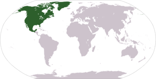
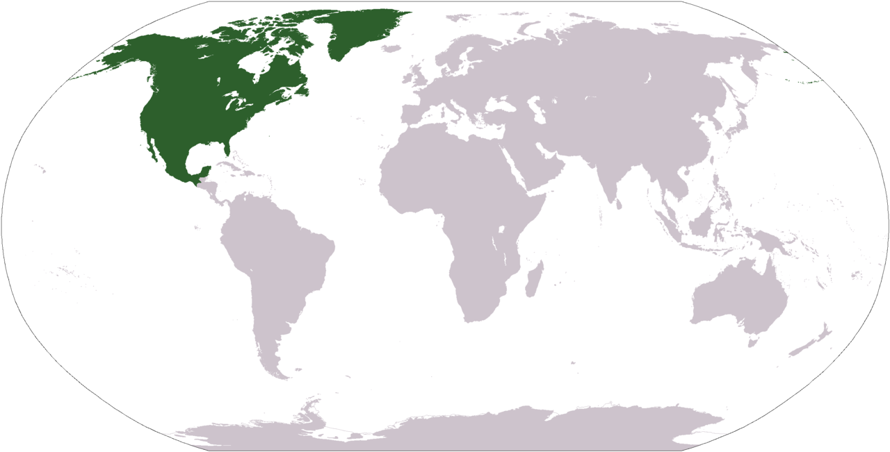
Mapa de ubicación geográfica de América del Norte ó Norteamérica. Location map of North America. Creado por/Designed by: Alex Covarrubias.
Paglisensya
| This work has been released into the public domain by its author, AlexCovarrubias at English Wikipidya. This applies worldwide. In some countries this may not be legally possible; if so: AlexCovarrubias grants anyone the right to use this work for any purpose, without any conditions, unless such conditions are required by law. |
Kasaysayan kan file
Pinduton an sarong petsa/oras para mahiling ng file sa puntong idto.
| Petsa/Oras | Thumbnail | Sukol | Paragamit | Komento | |
|---|---|---|---|---|---|
| presente | 19:23, 9 Nobyembre 2008 | | 2,759 × 1,404 (82 KB) | Ksiom | Transparency |
| 13:49, 1 Abril 2007 |  | 2,759 × 1,404 (102 KB) | AlexCovarrubias | Mapa de ubicación geográfica de América del Norte (Norteamérica). Location map of North America. Creado por/By AlexCovarrubias. ==Licensing== {{PD-user-en|AlexCovarrubias}} |
Paggamit sa file
Mayong pahinang naggagamit sa file na ini.
Pankinaban na paggamit sa file
Ginagamit kan mga minasunod na wiki an file na ini:
- Paggamit sa az.wikipedia.org
- Paggamit sa bs.wikipedia.org
- Paggamit sa en.wikipedia.org
- Talk:North America/Archive 3
- User talk:Hseldon10
- User:AlexCovarrubias
- User talk:3232330
- User:AlexCovarrubias/Userboxes
- User:AlexCovarrubias/Images
- User talk:Audiovore
- User talk:Aldoman
- User:Supaman89
- User talk:IkonicDeath
- Talk:North American Free Trade Agreement/Archive 1
- User talk:Publius97
- User talk:Alien8dave
- User talk:Polaris 2.9
- User talk:Yung dre 59
- User talk:THEPolyEngineer
- User:AlexNebraska/Userboxes
- User:Jesusmariajalisco
- User talk:Rajpalgrewal
- User talk:Sickero
- Talk:Canada/Archive 17
- User talk:Jesusmariajalisco
- User talk:Adriana Sanchez Ramirez
- User:AlexCovarrubias/Userboxes/NAFTA
- User talk:Paxuniv
- User:Scriberius/Babelmania
- User talk:Supaman89/Archive 2
- User talk:Deavenger/Archive 1
- Wikipedia talk:WikiProject Userboxes/New Userboxes/Archive 13
- User talk:Jcmenal/Archive 2008
- Talk:Mexico/Archive 6
- User:Scootercatter/sandMendos
- User:Reeeeeeeeeeeeeeeeeeeem20/sandbox
- Paggamit sa es.wikipedia.org
- Paggamit sa frp.wikipedia.org
- Paggamit sa hu.wikipedia.org
Hilingon an kadagdagan na pankinaban na paggamit sa file na ini.