Bhopal
Bhopal | |
|---|---|
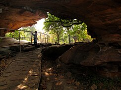
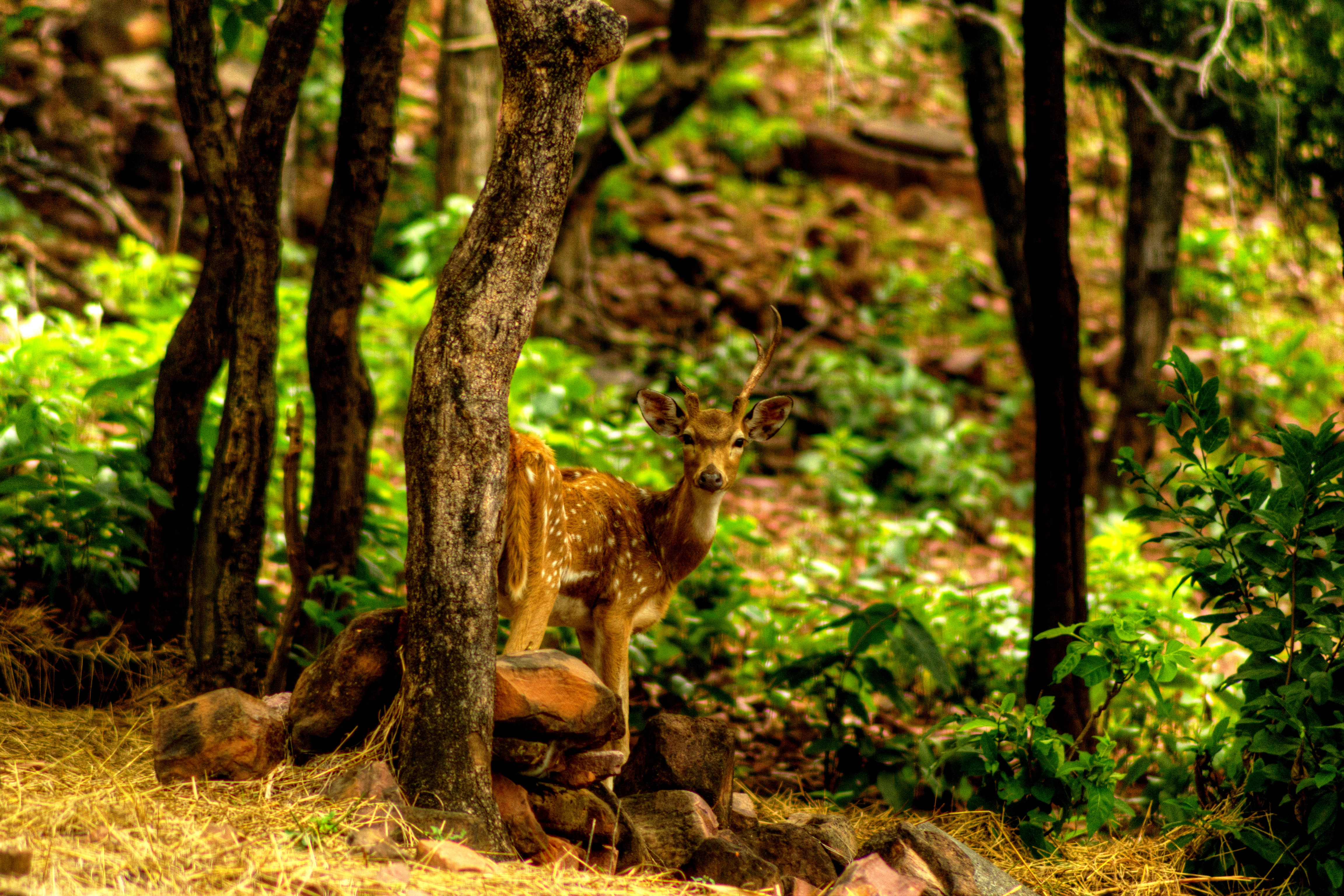
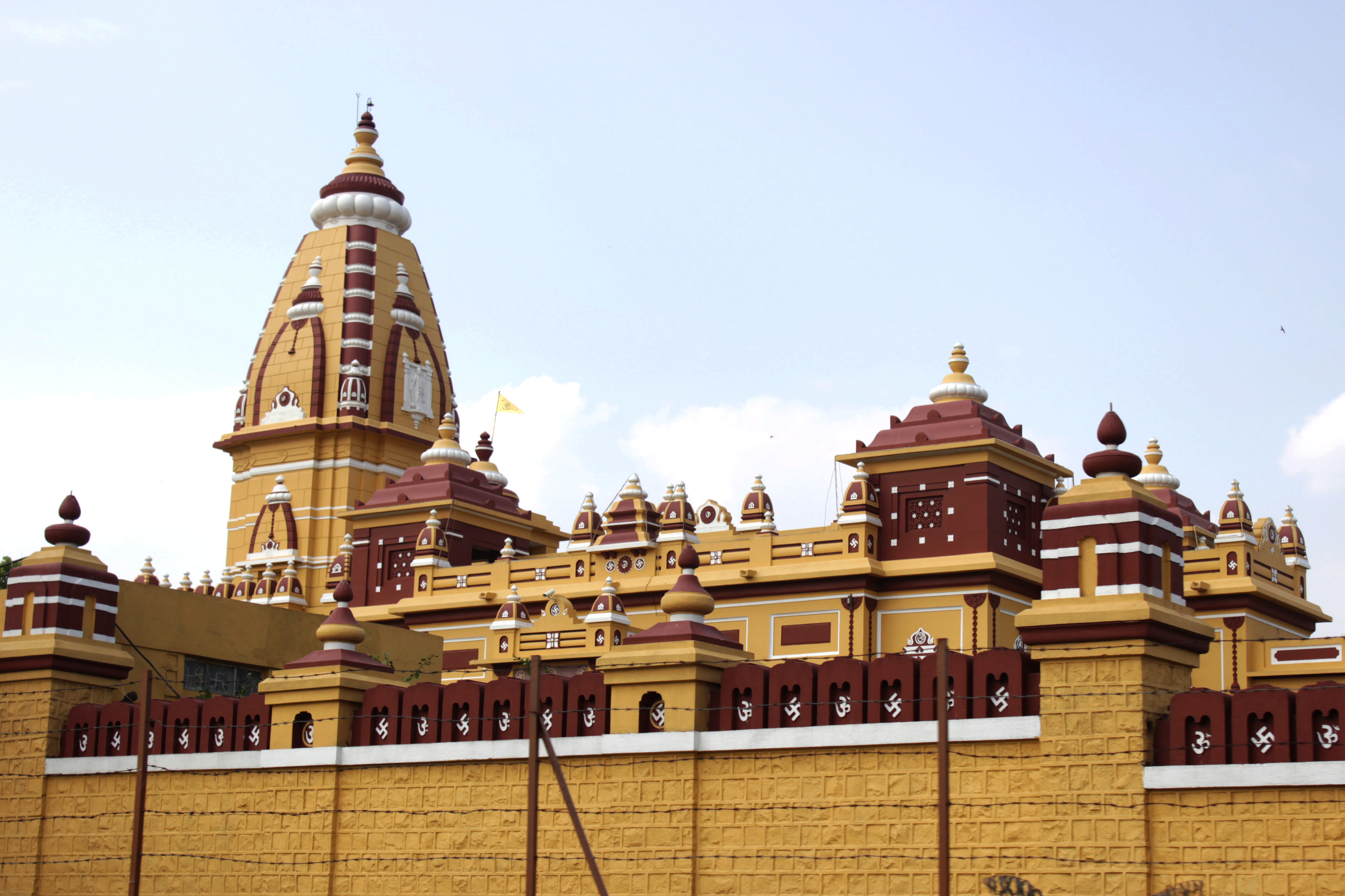
Clockwise from top: New Market area, Bhimbetka rock shelters (a UNESCO heritage site), Sanchi Stupa, Vallabh Bhawan (MP Secretariat), Bhopal Junction Railway Station, Raja Bhoj Setu, Birla Mandir, Van Vihar National Park, The City of Lakes Bhopal lighting, Ravindra Bhavan. | |
| Mga palayaw: The City of Lakes | |
| Lua error in Module:Mapa_nin_kinamumugtakan at line 485: Dae mahanap an ispesipikong depinisyon kan mapa nin kinamumugtakan: "Module:Mapa nin kinamumugtakan/datos/India Madhya Pradesh" an nag-iiral. | |
| Tagboan: Lua error in package.lua at line 80: module 'Module:ISO 3166/data/IN' not found. | |
| Country | |
| State | Madhya Pradesh |
| District | Bhopal |
| Region | Bhopal Division |
| Ward | 85 wards[1] |
| Pamamahala | |
| • Tipo | Mayor–Council |
| • Hawak | Bhopal Municipal Corporation |
| • Mayor | Malti Rai (BJP) |
| • Member of Parliament | Pragya Singh Thakur (2019 – present) |
| Hiwas | |
| • Metropolis | 463 km2 (179 sq mi) |
| • Metro | 648.24 km2 (250.29 sq mi) |
| Elebasyon | 527 m (1,729 ft) |
| Populasyon (2011)[4] | |
| • Metropolis | 1,798,218 |
| • Ranggo | 16th |
| • Densidad | 3,900/km2 (10,000/sq mi) |
| • Metro (Bhopal + Arera Colony + Berasia urban areas) | 1,917,051 |
| • Densidad kan metro | 3,000/km2 (7,700/sq mi) |
| • Metro rank | 18th |
| Mga demonym | Bhopali |
| Sona nin oras | UTC+5:30 (IST) |
| Pincode | 462001 to 462050 |
| Telephone | 0755 |
| Rehistradong behikulo | MP-04 |
| GDP Nominal | $5.35 billion[6] |
| Percapita | $2,087 or ₹1.47 lakh[6] |
| GDP Nominal (Bhopal District) | Rs. 44,175 crores (2020-21)[7] |
| Official language | Hindi |
| Literacy Rate (2011) | 80.37%[8] |
| Precipitation | 1,123.1 millimetres (44.22 in) |
| Avg. high temperature | 31.7 °C (89.1 °F) |
| Avg. low temperature | 18.6 °C (65.5 °F) |
| HDI (2016) | 0.77 (Plantilya:Colour)[9] |
| Websityo | bhopal |
An Bhopal (/boʊˈpɑːl/; Hindi: [bʱoːpaːl] (![]() dangogon)) iyo an kabiserang syudad kan estado kan Indya kan Madhya Pradesh asin an administratibong headquarters kan Bhopal district asin Bhopal division.[10][11] Midbid iyan bilang City of Lakes,[12] huli sa manlaenlaen na natural asin artipisyal na danaw. Saro man iyan sa pinakaberdeng syudad sa Indya.[13] Iyo iyan an ika-16 na pinadakulang syudad sa Indya asin an ika-131[14] sa kinaban. Pagkatapos kan pormasyon kan Madhya Pradesh, an Bhopal dating parte kan distrito kan Sehore. Nagin iyan na bifurcated kaidtong 1972 asin sarong bàgong distrito, naporma an Bhopal. Flourishing kaidtong 1707, an syudad iyo an kabisera kan dating Estado kan Bhopal, sarong princely state kan British pinamayuhan kan Nawabs of Bhopal. Dakol na pamanang estruktura poon sa panahon na iyan kabali an Taj-ul-Masajid asin Taj Mahal. Kaidtong 1984, an syudad sinalanta kan Bhopal disaster, saro sa makuring industriyal na kalamidad sa kasaysayan.
dangogon)) iyo an kabiserang syudad kan estado kan Indya kan Madhya Pradesh asin an administratibong headquarters kan Bhopal district asin Bhopal division.[10][11] Midbid iyan bilang City of Lakes,[12] huli sa manlaenlaen na natural asin artipisyal na danaw. Saro man iyan sa pinakaberdeng syudad sa Indya.[13] Iyo iyan an ika-16 na pinadakulang syudad sa Indya asin an ika-131[14] sa kinaban. Pagkatapos kan pormasyon kan Madhya Pradesh, an Bhopal dating parte kan distrito kan Sehore. Nagin iyan na bifurcated kaidtong 1972 asin sarong bàgong distrito, naporma an Bhopal. Flourishing kaidtong 1707, an syudad iyo an kabisera kan dating Estado kan Bhopal, sarong princely state kan British pinamayuhan kan Nawabs of Bhopal. Dakol na pamanang estruktura poon sa panahon na iyan kabali an Taj-ul-Masajid asin Taj Mahal. Kaidtong 1984, an syudad sinalanta kan Bhopal disaster, saro sa makuring industriyal na kalamidad sa kasaysayan.
Toltolan[baguhon | baguhon an source]
- ↑ "History". Bhopal Municipal Corporation (in English). Retrieved 13 November 2021.
- ↑ "BMC". Retrieved 19 November 2020.
- ↑ "BMC Plan". Retrieved 19 November 2020.
- ↑ 4.0 4.1 "District Census Handbook – Bhopal" (PDF). Census of India. p. 35. Archived from the original (PDF) on 7 August 2015. Retrieved 22 September 2015. Unknown parameter
|url-status=ignored (help) - ↑ "Bhopal Metro City".
- ↑ 6.0 6.1 "District Domestic Product Per Capita". Retrieved 8 January 2023.
- ↑ Records, Official. "Estimates of District Domestic Product Madhya Pradesh" (PDF). Department of Planning, Economics & Statistics, Govt. of Madhya Pradesh. Directorate of Economics and Statistics, Madhya Pradesh. Retrieved 2 January 2023.
- ↑ "Madhya Pradesh Literacy Rate 2021". www.indiacensus.net. Retrieved 13 November 2021.
- ↑ "The Madhya Pradesh Human Development Index" (PDF). 20 March 2016. Archived from the original (PDF) on 20 March 2016.
- ↑ Educational Britannica Educational (1 July 2010). The Geography of India: Sacred and Historic Places. The Rosen Publishing Group. pp. 174–. ISBN 978-1-61530-202-4. Archived from the original on 23 May 2013. Retrieved 15 April 2012. Unknown parameter
|url-status=ignored (help) - ↑ Limaye, P. (2014). "Bhopal Accident: Release of MIC". Encyclopedia of Toxicology. Elsevier. pp. 446–448. doi:10.1016/b978-0-12-386454-3.00252-9. ISBN 9780123864550.
Bhopal, the capital city of the state of Madhya Pradesh, India, is the site that witnessed probably the world's worst industrial calamity.
- ↑ The Geography of India: Sacred and Historic Places (in English). The Rosen Publishing Group, Inc. 2010. p. 174. ISBN 978-1-61530-142-3. Retrieved 11 August 2020.
- ↑ "MSN's 8 green cities of India – 7 – Bhopal". MSN India. 28 January 2010. Archived from the original on 28 December 2009. Retrieved 26 July 2010. Unknown parameter
|url-status=ignored (help) - ↑ "The world's largest cities". City Mayors. Archived from the original on 28 August 2017. Retrieved 16 August 2013. Unknown parameter
|url-status=ignored (help)


