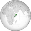
Ladawan:Somalia (orthographic projection).svg
Appearance

Size of this PNG preview of this SVG file: 553 × 553 na pixel. Ibang mga resolusyon: 240 × 240 na pixel | 480 × 480 na pixel | 768 × 768 na pixel | 1,024 × 1,024 na pixel | 2,048 × 2,048 na pixel.
Orihinal na file (SVG na file, nominal na 553 × 553 (na) pixel, pakadakula: 263 KB)
Kasaysayan kan file
Pinduton an sarong petsa/oras para mahiling ng file sa puntong idto.
| Petsa/Oras | Thumbnail | Sukol | Paragamit | Komento | |
|---|---|---|---|---|---|
| presente | 08:04, 4 Abril 2024 |  | 553 × 553 (263 KB) | Maram089 | Reverted to version as of 07:11, 4 April 2024 (UTC) |
| 07:48, 4 Abril 2024 |  | 553 × 553 (362 KB) | Buufin | Reverted to version as of 07:02, 4 April 2024 (UTC) You're clearly here to build a Pan-Somalism ideology | |
| 07:11, 4 Abril 2024 |  | 553 × 553 (263 KB) | Maram089 | Reverted to version as of 03:19, 4 April 2024 (UTC) you are causing vandalism as we can see the lack of consensus and your insistence in adopting a map that lacks credibility | |
| 07:02, 4 Abril 2024 |  | 553 × 553 (362 KB) | Buufin | Reverted to version as of 22:30, 3 April 2024 (UTC) | |
| 03:19, 4 Abril 2024 |  | 553 × 553 (263 KB) | Salma3232 | Reverted to version as of 19:28, 3 April 2024 (UTC) Shows SSC Khatumo as part of SL inaccurate and misleading | |
| 22:30, 3 Abril 2024 |  | 553 × 553 (362 KB) | Buufin | Reverted to version as of 07:52, 3 April 2024 (UTC) Light green represents disputed territory | |
| 19:28, 3 Abril 2024 |  | 553 × 553 (263 KB) | Nawal00 | Reverted to version as of 08:01, 14 December 2023 (UTC). SSC Khatumo control 30% of territories claimed by SL, more than once city. SSC Khatumo is a federal member state recognised by the Somali Government. The current border is the dejure border recognised by the international community as Somalia | |
| 07:52, 3 Abril 2024 |  | 553 × 553 (362 KB) | Jethro1945 | Reverted to version as of 02:09, 14 December 2023 (UTC) Somalia does not control the territory of Somaliland. The so called Khatumo state of Somalia entity controls certain areas of eastern Somaliland that doesn’t mean Somalia controls the whole territory of Somaliland | |
| 08:01, 14 Disyembre 2023 |  | 553 × 553 (263 KB) | Maram089 | Reverted to version as of 21:03, 12 December 2023 (UTC) South Sudan is a sovereign country that has a dispute with another sovereign country Sudan. Somaliland once I searched and read is NOT sovereign neither it control the light green entity that it claims. | |
| 02:09, 14 Disyembre 2023 |  | 553 × 553 (362 KB) | Zinderboff | Reverted to version as of 18:15, 12 December 2023 (UTC) Standard procedure for dispute territories and unrecognised/partially-recognised states, if South Sudan for example with all it’s instability and lack of central government control has it’s disputed borders shown I don’t see why Somalia would be any different. |
Paggamit sa file
Mayong pahinang naggagamit sa file na ini.
Pankinaban na paggamit sa file
Ginagamit kan mga minasunod na wiki an file na ini:
- Paggamit sa ann.wikipedia.org
- Paggamit sa arc.wikipedia.org
- Paggamit sa ar.wikipedia.org
- الصومال
- الحكومة الوطنية الانتقالية
- مستخدم:جار الله/قائمة صور مقالات العلاقات الثنائية
- العلاقات الصومالية الأمريكية
- العلاقات الأنغولية الصومالية
- العلاقات الصومالية الإريترية
- العلاقات الصومالية السويسرية
- العلاقات الألمانية الصومالية
- العلاقات الصومالية الليختنشتانية
- العلاقات الصومالية البوليفية
- العلاقات الصومالية الموزمبيقية
- العلاقات الألبانية الصومالية
- العلاقات الصومالية البلجيكية
- العلاقات الصومالية البيلاروسية
- العلاقات الصومالية الطاجيكستانية
- العلاقات الصومالية الروسية
- العلاقات الصومالية الرومانية
- العلاقات الأرجنتينية الصومالية
- العلاقات الصومالية الغامبية
- العلاقات الصومالية القبرصية
- العلاقات الصومالية السيراليونية
- العلاقات الصومالية النيبالية
- العلاقات الصومالية الليبيرية
- العلاقات التشيكية الصومالية
- العلاقات الصومالية الميانمارية
- العلاقات الصومالية الكندية
- العلاقات السعودية الصومالية
- العلاقات الصومالية الزيمبابوية
- العلاقات الصومالية الإسرائيلية
- العلاقات الصومالية البالاوية
- العلاقات الصومالية المالية
- العلاقات الصومالية النيجيرية
- العلاقات الصومالية اليمنية
- العلاقات الصومالية الفانواتية
- العلاقات الصومالية الغابونية
- العلاقات الصومالية البنمية
- العلاقات الصومالية الكوبية
- العلاقات الصومالية الجورجية
- العلاقات الصومالية التونسية
- العلاقات الصومالية الكورية الشمالية
- العلاقات الصومالية الهندية
- العلاقات الصومالية اليابانية
- العلاقات الصومالية الإيطالية
- العلاقات الصومالية الناوروية
- العلاقات الأسترالية الصومالية
- العلاقات الصومالية الزامبية
- العلاقات الصومالية الفيجية
- العلاقات الصومالية المارشالية
Hilingon an kadagdagan na pankinaban na paggamit sa file na ini.


