
Ladawan:States of India (Survey of India).pdf

Size of this JPG preview of this PDF file: 424 × 600 na pixel. Ibang mga resolusyon: 170 × 240 na pixel | 339 × 480 na pixel | 543 × 768 na pixel | 1,239 × 1,752 na pixel.
Orihinal na file (1,239 × 1,752 na pixel, pakadakula: 353 KB, tipo nin MIME: application/pdf)

|
File:States of India (Survey of India).svg is a vector version of this file. It should be used in place of this PDF file when not inferior.
File:States of India (Survey of India).pdf → File:States of India (Survey of India).svg
For more information, see Help:SVG. |
.svg) |
Sumaryo
| Pagladawan |
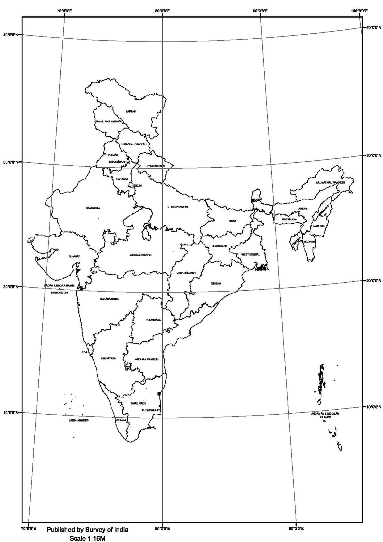
English: Map of the States of India, as assessed and asserted by India. Portions of the territory may be under claim or control of other nations. |
| Pinagkunan | Survey of India |
| Kagsurat | Survey of India |
| Pagtugot (Giraray na paggamit sa file) |
Paglisensya
| This work has been released into the public domain by its author, Survey of India. This applies worldwide. In some countries this may not be legally possible; if so: Survey of India grants anyone the right to use this work for any purpose, without any conditions, unless such conditions are required by law.
|
Kasaysayan kan file
Pinduton an sarong petsa/oras para mahiling ng file sa puntong idto.
| Petsa/Oras | Thumbnail | Sukol | Paragamit | Komento | |
|---|---|---|---|---|---|
| presente | 19:20, 26 Abril 2023 |  | 1,239 × 1,752 (353 KB) | Guerillero | {{Information |Description= {{en|Map of the States of Indian}} |Source= Survey of Indian |Date= |Author= Survey of Indian |Permission= |other_versions= }} {{subst:PP}} |
Paggamit sa file
Mayong pahinang naggagamit sa file na ini.