
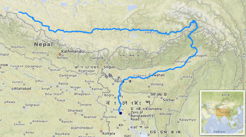
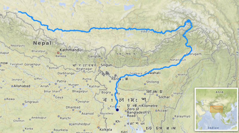
Ladawan:Brahmapoutre.png
Pakadakula kan pasirip na ini: 800 × 447 na pixel. Ibang mga resolusyon: 320 × 179 na pixel | 824 × 460 na pixel.
Orihinal na file (824 × 460 na pixel, pakadakula: 781 KB, tipo nin MIME: image/png)
Sumaryo
| Pagladawan |
Français : carte réalisée sur umap [1] |
|||||||||||||||
| Petsa | ||||||||||||||||
| Pinagkunan |
|
|||||||||||||||
| Kagsurat | OpenStreetMap contributors |
Paglisensya
I, the copyright holder of this work, hereby publish it under the following license:
This file is licensed under the Creative Commons Attribution-Share Alike 4.0 International license.
- Talingkas mo ining:
- maihiras – makokopya, maipapanao, asin maipapahiling an gibo
- i-remix – ma-adapt an gibo
- Sa irarom kan mga kondisyon na ini:
- atribusyon – Dapat mong i-credit, itao an link kan lisensya, at itukdo kun may binago ini. Pwede mo ining gibuhon sa dawa anong rasonableng paagi, pero bako sa paaging ineendorso ka o an paggamit mo kan naglisensya.
- share alike – Kun ire-remix mo, babaguhon, o madagdag sa materyal, kaipuhan mong ipanao an mga ambag mo sa irarom kan parehas o katulad na lisensya.
Kasaysayan kan file
Pinduton an sarong petsa/oras para mahiling ng file sa puntong idto.
| Petsa/Oras | Thumbnail | Sukol | Paragamit | Komento | |
|---|---|---|---|---|---|
| presente | 11:44, 8 Nobyembre 2019 | | 824 × 460 (781 KB) | Ccmpg | User created page with UploadWizard |
Paggamit sa file
Ginagamit kan minasunod na pahina an file na ini:
Pankinaban na paggamit sa file
Ginagamit kan mga minasunod na wiki an file na ini:
- Paggamit sa ar.wikipedia.org
- Paggamit sa arz.wikipedia.org
- Paggamit sa ast.wikipedia.org
- Paggamit sa bs.wikipedia.org
- Paggamit sa ca.wikipedia.org
- Paggamit sa da.wikipedia.org
- Paggamit sa en.wikipedia.org
- Paggamit sa eo.wikipedia.org
- Paggamit sa es.wikipedia.org
- Paggamit sa eu.wikipedia.org
- Paggamit sa frr.wikipedia.org
- Paggamit sa fr.wikipedia.org
- Paggamit sa gu.wikipedia.org
- Paggamit sa hy.wikipedia.org
- Paggamit sa io.wikipedia.org
- Paggamit sa it.wikipedia.org
- Paggamit sa ms.wikipedia.org
- Paggamit sa no.wikipedia.org
- Paggamit sa os.wikipedia.org
- Paggamit sa pnb.wikipedia.org
- Paggamit sa th.wikipedia.org
- Paggamit sa uk.wikipedia.org
- Paggamit sa ur.wikipedia.org
- Paggamit sa uz.wikipedia.org
- Paggamit sa vi.wikipedia.org
- Paggamit sa www.wikidata.org