
Ladawan:Lava Fountains and Lava Flows at Piton de la Fournaise 2016.jpg
Pakadakula kan pasirip na ini: 800 × 500 na pixel. Ibang mga resolusyon: 320 × 200 na pixel | 640 × 400 na pixel | 1,024 × 640 na pixel | 1,280 × 800 na pixel | 2,560 × 1,600 na pixel | 4,320 × 2,700 na pixel.
Orihinal na file (4,320 × 2,700 na pixel, pakadakula: 4.16 MB, tipo nin MIME: image/jpeg)
Sumaryo
| Pagladawan |
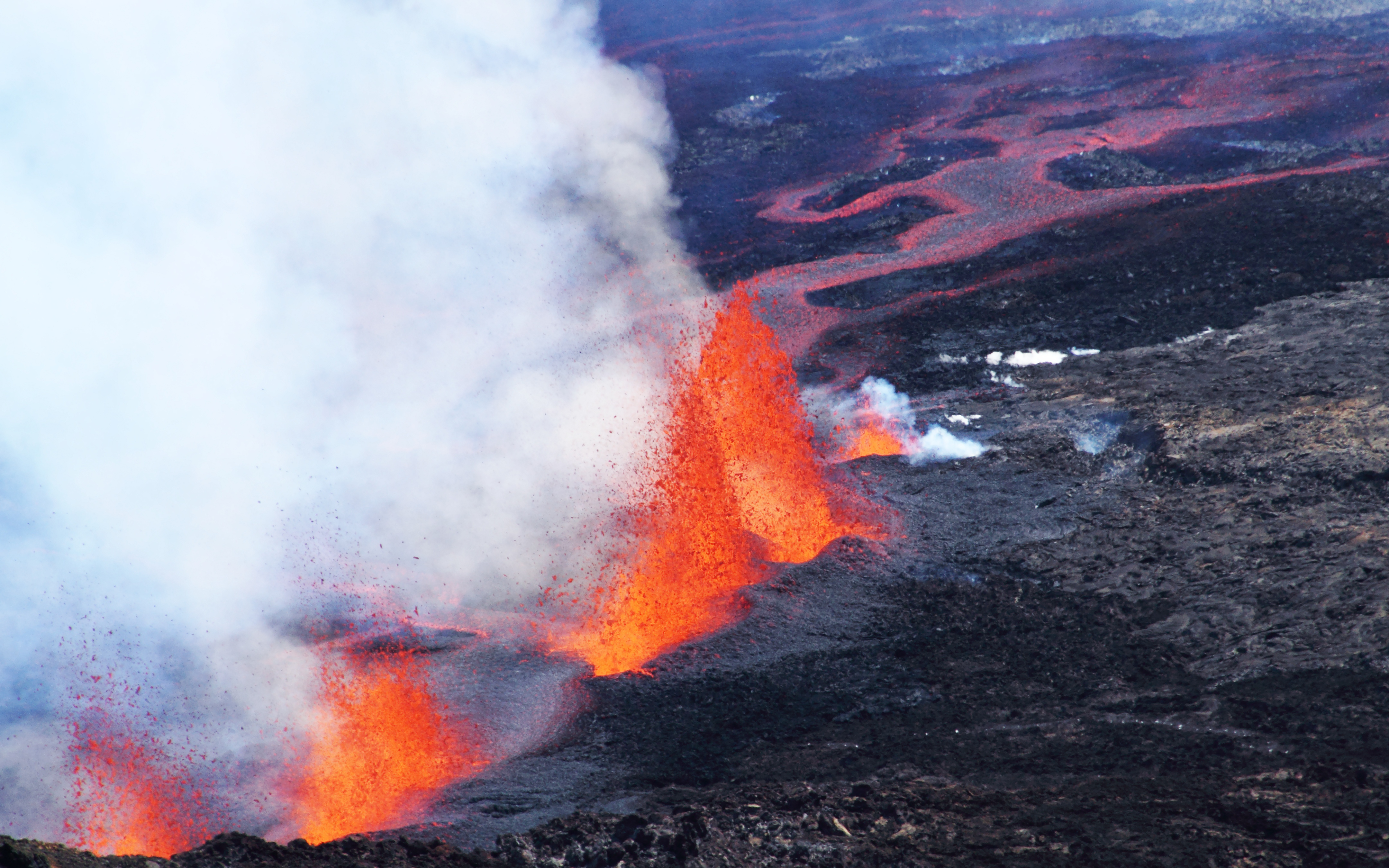
English: The shield volcano Piton de la Fournaise (island of La Réunion) is one of the most active volcanoes in the world. This photo shows 20–30 m high lava fountains and the associated flows just one and a half hours after the sudden onset of a fissure eruption, in September 2016, along the slope heading from the main crater, Cratère Dolomieu, down to the caldera Enclos Fouqué. Credit: Martin Mergili (distributed via imaggeo.egu.eu) |
| Petsa | |
| Pinagkunan | https://imaggeo.egu.eu/view/5150/ |
| Kagsurat | Martin Mergili (BOKU University, Vienna) (https://imaggeo.egu.eu/user/358/) |
| Camera location | | View this and other nearby images on: OpenStreetMap |
|---|
Paglisensya
This file is licensed under the Creative Commons Attribution 3.0 Unported license.
- Talingkas mo ining:
- maihiras – makokopya, maipapanao, asin maipapahiling an gibo
- i-remix – ma-adapt an gibo
- Sa irarom kan mga kondisyon na ini:
- atribusyon – Dapat mong i-credit, itao an link kan lisensya, at itukdo kun may binago ini. Pwede mo ining gibuhon sa dawa anong rasonableng paagi, pero bako sa paaging ineendorso ka o an paggamit mo kan naglisensya.
This file, which was originally posted to
https://imaggeo.egu.eu/view/5150/, was reviewed on 21 May 2018 by reviewer Leoboudv, who confirmed that it was available there under the stated license on that date.
|
Kasaysayan kan file
Pinduton an sarong petsa/oras para mahiling ng file sa puntong idto.
| Petsa/Oras | Thumbnail | Sukol | Paragamit | Komento | |
|---|---|---|---|---|---|
| presente | 20:56, 20 Mayo 2018 | | 4,320 × 2,700 (4.16 MB) | GeoWriter | User created page with UploadWizard |
Paggamit sa file
Ginagamit kan minasunod na pahina an file na ini:
Pankinaban na paggamit sa file
Ginagamit kan mga minasunod na wiki an file na ini:
- Paggamit sa fr.wiktionary.org