
Ladawan:Locator map Tutong in Brunei.svg

Size of this PNG preview of this SVG file: 527 × 599 na pixel. Ibang mga resolusyon: 211 × 240 na pixel | 422 × 480 na pixel | 676 × 768 na pixel | 901 × 1,024 na pixel | 1,802 × 2,048 na pixel | 938 × 1,066 na pixel.
Orihinal na file (SVG na file, nominal na 938 × 1,066 (na) pixel, pakadakula: 104 KB)
This W3C-unspecified vector image was created with Inkscape .
Sumaryo
| Pagladawan | |
| Petsa | |
| Pinagkunan | Brunei map-en.svg |
| Kagsurat | Tachymètre (talk) |
Paglisensya
| This work has been released into the public domain by its author, Tachymètre. This applies worldwide. In some countries this may not be legally possible; if so: |
Kasaysayan kan file
Pinduton an sarong petsa/oras para mahiling ng file sa puntong idto.
| Petsa/Oras | Thumbnail | Sukol | Paragamit | Komento | |
|---|---|---|---|---|---|
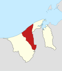
| presente | 14:00, 26 Pebrero 2011 | | 938 × 1,066 (104 KB) | Tachymètre | {{Created with Inkscape}} == {{int:filedesc}} == {{Information |Description= {{en|Locator map of Tutong in Brunei.}} {{de|Lage von Tutong in Brunei.}} {{fr|Carte géolocalisée de [[:fr: |
Paggamit sa file
Ginagamit kan minasunod na pahina an file na ini:
Pankinaban na paggamit sa file
Ginagamit kan mga minasunod na wiki an file na ini:
- Paggamit sa ar.wikipedia.org
- Paggamit sa ast.wikipedia.org
- Paggamit sa bg.wikipedia.org
- Paggamit sa bn.wikipedia.org
- Paggamit sa cs.wikipedia.org
- Paggamit sa de.wikipedia.org
- Paggamit sa de.wikivoyage.org
- Paggamit sa el.wikipedia.org
- Paggamit sa en.wikipedia.org
- Paggamit sa es.wikipedia.org
- Paggamit sa eu.wikipedia.org
- Paggamit sa fi.wikipedia.org
- Paggamit sa frr.wikipedia.org
- Paggamit sa fr.wikipedia.org
- Paggamit sa he.wikipedia.org
- Paggamit sa it.wikipedia.org
- Paggamit sa ko.wikipedia.org
- Paggamit sa lv.wikipedia.org
- Paggamit sa ms.wikipedia.org
- Paggamit sa nl.wikipedia.org
- Paggamit sa no.wikipedia.org
- Paggamit sa pl.wikipedia.org
- Paggamit sa ru.wikipedia.org
- Paggamit sa simple.wikipedia.org
- Paggamit sa sv.wikipedia.org
- Paggamit sa th.wikipedia.org
- Paggamit sa tr.wikipedia.org
- Paggamit sa uk.wikipedia.org
- Paggamit sa www.wikidata.org
- Paggamit sa zh-min-nan.wikipedia.org
- Paggamit sa zh-yue.wikipedia.org
- Paggamit sa zh.wikipedia.org