
Ladawan:Taiwan location map.svg

Size of this PNG preview of this SVG file: 499 × 600 na pixel. Ibang mga resolusyon: 200 × 240 na pixel | 399 × 480 na pixel | 639 × 768 na pixel | 852 × 1,024 na pixel | 1,704 × 2,048 na pixel | 1,016 × 1,221 na pixel.
Orihinal na file (SVG na file, nominal na 1,016 × 1,221 (na) pixel, pakadakula: 121 KB)

|
This file requires updating. In doing so, you could add a timestamp to the file.
|

|
The boundaries on this map show the de facto situation. This is just one of several different views on the subject (see COM:NPOV). |
Sumaryo
| Pagladawan |
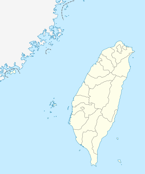
Quadratische Plattkarte, N-S-Streckung 110 %. Geographische Begrenzung der Karte:
Equirectangular projection, N/S stretching 110 %. Geographic limits of the map:
|
| Petsa | |
| Pinagkunan | own work, using United States National Imagery and Mapping Agency data |
| Kagsurat | NordNordWest |

|
This map has been made or improved in the German Kartenwerkstatt (Map Lab). You can propose maps to improve as well.
|
Paglisensya
I, the copyright holder of this work, hereby publish it under the following licenses:

|
Tinutugutan an pagkopya, pagpanao, asin/o pagbago sa dokumentong ini sa irarom kan mga termino kan GNU Free Documentation License, Bersyon 1.2 o dawa anong mas bagong bersyon na naipublikar kan Free Software Foundation; na mayong paburubagong seksyon, mayong teksto sa front-cover, asin walang teksto sa back-cover. Igwang nakalaag na kopya kan lisensya sa seksyon na may titulong GNU Free Documentation License. |
Nakalisensya an file na ini sa irarom kan lisensyang Creative Commons Attribution-Share Alike 3.0 Unported.
- Talingkas mo ining:
- maihiras – makokopya, maipapanao, asin maipapahiling an gibo
- i-remix – ma-adapt an gibo
- Sa irarom kan mga kondisyon na ini:
- atribusyon – Dapat mong i-credit, itao an link kan lisensya, at itukdo kun may binago ini. Pwede mo ining gibuhon sa dawa anong rasonableng paagi, pero bako sa paaging ineendorso ka o an paggamit mo kan naglisensya.
- share alike – Kun ire-remix mo, babaguhon, o madagdag sa materyal, kaipuhan mong ipanao an mga ambag mo sa irarom kan parehas o katulad na lisensya.
Pwede kang makapili nin lisensya mo.
Kasaysayan kan file
Pinduton an sarong petsa/oras para mahiling ng file sa puntong idto.
| Petsa/Oras | Thumbnail | Sukol | Paragamit | Komento | |
|---|---|---|---|---|---|
| presente | 11:15, 22 Agosto 2011 | | 1,016 × 1,221 (121 KB) | NordNordWest | minor corrections |
| 11:54, 19 Hulyo 2011 |  | 1,016 × 1,222 (166 KB) | Bencmq | Reverted to the version before dispute | |
| 09:46, 19 Hulyo 2011 |  | 1,016 × 1,222 (156 KB) | JOSH tw | You did not answer my query. If you would like to use this file on global website of wiki commons, you have to consider different concepts in order to keep it neutral | |
| 07:24, 19 Hulyo 2011 |  | 1,016 × 1,221 (121 KB) | NordNordWest | You can upload a new file if you want to, but don't change the status that is shown here. Next revert -> COM:V | |
| 04:20, 19 Hulyo 2011 |  | 1,016 × 1,222 (156 KB) | JOSH tw | If Kosovo as an UN unreconignized state can be shown on distinct appearance with Serbia, there is unreasonable to treat each other differently... especially P.R.China has never ruled Taiwan at any period of history | |
| 21:59, 18 Hulyo 2011 |  | 1,016 × 1,221 (121 KB) | NordNordWest | please don't change the political status shown in this map | |
| 20:23, 18 Hulyo 2011 |  | 1,016 × 1,222 (156 KB) | JOSH tw | Fixed map, political divisions have changed | |
| 16:54, 3 Hunyo 2011 |  | 1,016 × 1,221 (127 KB) | NordNordWest | please don't change the political status shown in this map | |
| 13:19, 3 Hunyo 2011 |  | 1,016 × 1,222 (156 KB) | Energiya | Fix the border of Matsu(Dongyin) and Kinmen (Dadan, Erdan, Wuqiu) see the page of Matsu Island and Kinmen. | |
| 17:19, 28 Disyembre 2010 |  | 1,016 × 1,222 (166 KB) | NordNordWest | wrong upd |
Paggamit sa file
Ginagamit kan minasunod na pahina an file na ini:
Pankinaban na paggamit sa file
Ginagamit kan mga minasunod na wiki an file na ini:
- Paggamit sa af.wikipedia.org
- Paggamit sa an.wikipedia.org
- Paggamit sa ar.wikipedia.org
- Paggamit sa ast.wikipedia.org
- Taiwán
- Taipei 101
- Taipéi
- Nuevu Taipéi
- Keelung
- Taoyuan
- Taichung
- Muséu Nacional del Palaciu
- Islles Pescadores
- Módulu:Mapa de llocalización/datos/República de China
- Módulu:Mapa de llocalización/datos/Taiwán
- Módulu:Mapa de llocalización/datos/República de China/usu
- Aeropuertu Internacional de Taiwán Taoyuan
- Puertu de Kaohsiung
- Puertu de Taipéi
- Paggamit sa az.wikipedia.org
- Paggamit sa ba.wikipedia.org
- Paggamit sa be.wikipedia.org
- Paggamit sa bg.wikipedia.org
- Paggamit sa bn.wikipedia.org
- Paggamit sa bs.wikipedia.org
- Paggamit sa ceb.wikipedia.org
Hilingon an kadagdagan na pankinaban na paggamit sa file na ini.