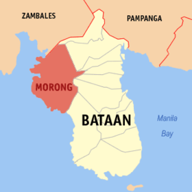
Morong, Bataan
Appearance
Morong | |
|---|---|
 Kinamumugtakan kan Morong | |
 | |
| Tagboan: 14°40′48″N 120°16′6″E Tagboan: 14°40′48″N 120°16′6″E | |
| Nasyon | Filipinas |
| Barangay | 5 |
| Pamamahala | |
| • Electorado | 23,488 votantes (9 Mayo 2022) |
| Hiwas | |
| • Kabuuhan | 219.20 km2 (84.63 sq mi) |
| Elebasyon | 24 m (79 ft) |
| Populasyon (Mayo 1, 2020)[1] | |
| • kabuuhan | 35,394 |
| • Densidad | 160/km2 (420/sq mi) |
| • Saro | 8,278 |
| Economia | |
| • Klase | ikatolo na klaseng banwaan |
| • Ingresos | ₱223,076,257.9086,654,246.0591,845,342.82108,362,127.80127,919,581.52141,495,388.03170,356,879.52173,297,231.83223,842,314.62235,377,100.45333,355,099.75 (2020) |
| • Activos | ₱496,915,506.41125,078,185.73116,995,681.37116,384,075.70169,900,288.31207,809,029.53325,662,656.30357,667,777.73458,369,460.06571,681,099.02664,297,238.18 (2020) |
| • Pasivos | ₱103,495,296.6070,454,416.0259,081,996.7851,788,114.1076,544,418.6470,240,392.51100,654,361.5683,592,551.73105,152,069.30147,116,563.58114,152,159.95 (2020) |
| • Gastos | ₱192,052,314.7771,725,823.2469,958,731.6071,946,593.3283,096,394.8491,992,739.25103,797,298.56129,363,720.86144,912,208.08202,957,774.82240,832,387.75 (2020) |
| Kodigo nin postal | 2105 |
| PSGC | 030808000 |
| Kodigo telefonico | 47 |
| Tataramon | Tataramon na Maribelenyo tataramon na Tagalog |
An Morong sarong ikaapat na klaseng banwaan kan probinsya nin Bataan, Filipinas. Igwa ining sukol na 219.20 kilometro kwadrado. An designadong zip code kaini iyo 2105.
Susog sa sensus kan 1 Mayo 2020, igwa ining 35,394 katawong nag-eerok digdi sa 8,278 kaharongan.
Mga Barangay
[baguhon | baguhon an source]
An Morong nababanga sa 5 barangay.
- Binaritan
- Mabayo
- Nagbalayong
- Poblacion
- Sabang
Turismo
[baguhon | baguhon an source]Mga Resort sa Baybayon
- Dorothy Beach Resort
- Juness Beach Resort
- Bataan White Corals Beach Resort
- Coral view Beach Resort
- Morong Star Beach Resort
- Waterfront Beach Resort
- Delia's Beach Resort
- Avell Beach Resort
- Erc Beach Resort
Hilnga Man
[baguhon | baguhon an source]Demograpiko
[baguhon | baguhon an source]| Taon | Tawo | ±% p.a. |
|---|---|---|
| 1903 | 1,906 | — |
| 1918 | 2,576 | +2.03% |
| 1939 | 3,301 | +1.19% |
| 1948 | 3,336 | +0.12% |
| 1960 | 5,734 | +4.62% |
| 1970 | 6,738 | +1.62% |
| 1975 | 7,793 | +2.96% |
| 1980 | 10,637 | +6.42% |
| 1990 | 17,155 | +4.90% |
| 1995 | 18,731 | +1.66% |
| 2000 | 21,273 | +2.77% |
| 2007 | 27,119 | +3.41% |
| 2010 | 26,171 | −1.29% |
| 2015 | 29,901 | +2.57% |
| 2020 | 35,394 | +3.37% |
| Toltolan: Philippine Statistics Authority[2][3][4][5] | ||
Toltolan
[baguhon | baguhon an source]- ↑ "2020 Census of Population and Housing (2020 CPH) Population Counts Declared Official by the President". Hulyo 7, 2021. Check date values in:
|date=(help) - ↑ Sensus kan Populasyon (2015). "Region III (Sentral Luzon)". Kabuuhang Populasyon kan lambang Provincia, Syudad, Banwaan asin Barangay. PSA. Retrieved 20 Jun 2016.
- ↑ Census of Population and Housing (2010). "Rehiyon III (Sentral Luzon)". Kabuuhan populasyon sa lambang Provincia, Syudad, Banwaan asin Barangay. NSO. Retrieved 29 Jun 2016.
- ↑ Mga Sensus kan Populasyon (1903–2007). "Rehiyon III (Sentral Luzon)". Table 1. Population Enumerated in Various Censuses by Province/Highly Urbanized City: 1903 to 2007. NSO.
- ↑ "Province of Bataan". Municipality Population Data. LWUA Research Division. Retrieved 17 December 2016.
